
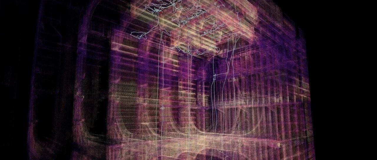
Industrial Drones · Confined-Space Inspection
Inside large storage tanks, ship compartments, boilers and other complex industrial facilities, inspectors need not only to see the actual condition of equipment surfaces, but also to understand the internal spatial structure and accurately record the locations of any anomalies they find.
Traditional visual inspection relies mainly on photographs, video and manual records. When the inspection covers a large area with a complex internal structure, matching inspection images to their actual spatial locations often becomes a challenge in subsequent data organisation and analysis.
The Scout 137 Gen3 tethered industrial drone system introduced by Norway's ScoutDI offers a new approach to this problem through 3D LiDAR and a digital data platform.
If a drone can build a spatial map while capturing inspection images, what value could the inspection data offer?
01 3D LiDAR: Sensing the Space
Traditional cameras primarily capture images and video, whereas 3D LiDAR measures the distance between surrounding objects and the sensor by emitting laser light and receiving reflected signals, acquiring three-dimensional spatial information about the environment.
Scout 137 Gen3 is equipped with survey-grade 3D LiDAR and combines it with LiDAR/SLAM technology to assist drone positioning and spatial mapping in environments without GPS signals.
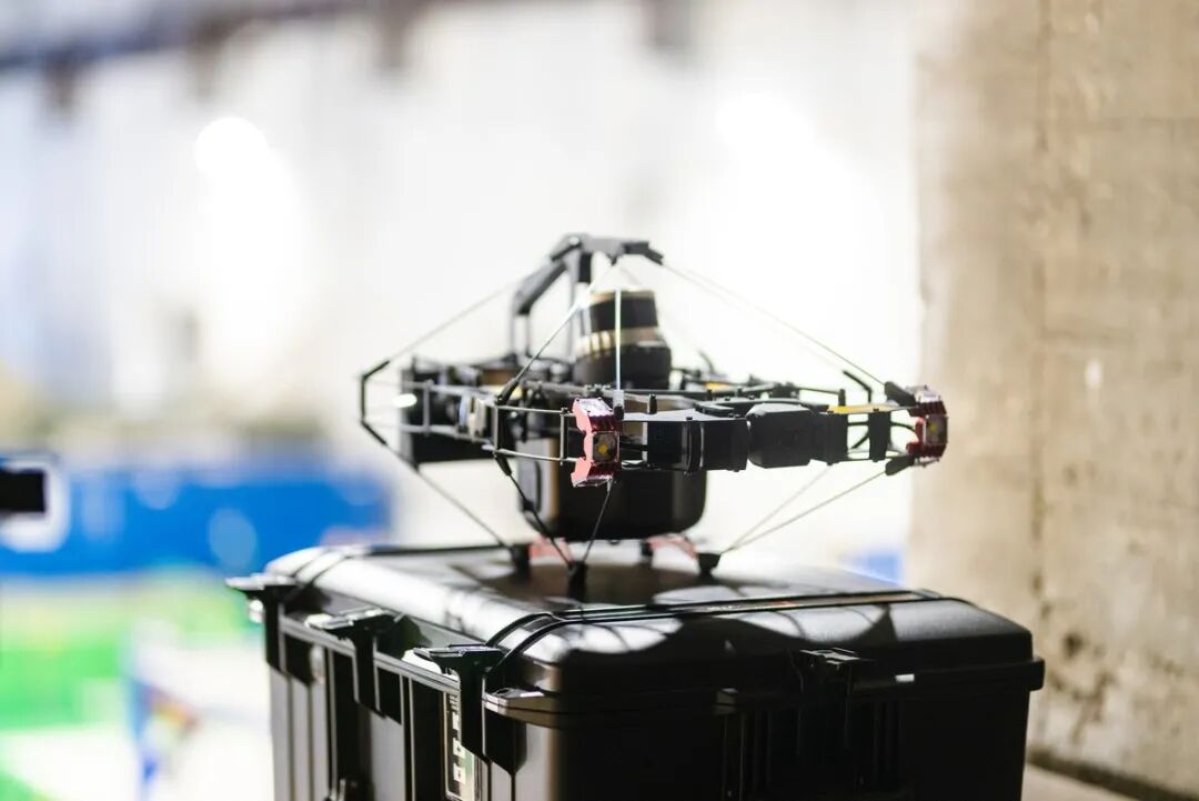
Scout 137 Gen3 equipped with 3D LiDAR
During actual inspections, the system can present the spatial information it collects as a 3D point cloud.
Put simply, traditional imagery mainly answers “what was seen”, while a 3D point cloud helps operators further understand “how these structures are distributed in space”.
This enables the drone not only to observe the inside of equipment, but also to help on-site teams develop an overall understanding of complex spaces.
02 3D Point Clouds: Understanding Where You Are
Inside large storage tanks or ship compartments, video images alone can sometimes make it difficult to quickly determine the drone's current position and which areas have already been inspected.
Through 3D point-cloud visualisation, flight-path tracking and spatial awareness, Scout 137 Gen3 helps operators understand the positional relationship between the drone and surrounding structures more intuitively.
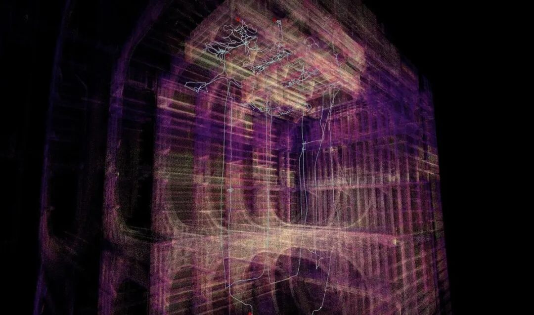
Point cloud and flight path: current position and inspected areas at a glance
For industrial facilities with complex structures and numerous obstacles, these functions can assist flight operations and inspection-route planning.
Combining inspection images with a spatial map helps operators keep track of inspection progress and makes it easier to assess complex internal structures.
03 POI Markers: Linking Findings to Actual Locations
Industrial inspection aims not only to identify anomalies, but also to record where they are located, facilitating subsequent review and maintenance.
For example, when inspecting the inner wall of a large storage tank, operators may find suspected corrosion, coating damage or other surface anomalies. With only photographs or video, those reviewing the findings later still need to consult the inspection records to determine the exact location.
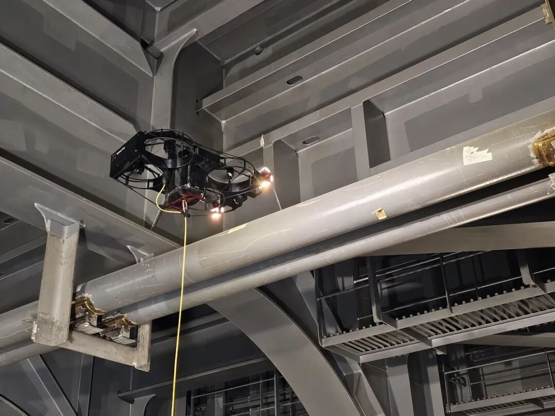
The more complex the structure, the more important it is to be able to pinpoint an anomaly's location
Scout 137 Gen3 supports linking POIs (points of interest) marked during inspection to the flight path and displaying them in the 3D model, helping inspectors understand the spatial relationships between key inspection locations.
For inspection tasks using the UTM ultrasonic thickness measurement module, the system can also link measurement points to the 3D model, making it easier to consult the associated measurement data later.
This means inspection data is no longer just a collection of separate images and measurement records: it can be linked to spatial location information, providing a reference for subsequent analysis.
04 From Flight to 3D: Traceable Data
From on-site acquisition to subsequent analysis, the value of 3D LiDAR also lies in how inspection data is organised and used.
Through the Scout Portal data platform, inspectors can combine 3D visualisation, flight paths, POI markers and related imagery to review, analyse and share inspection results.
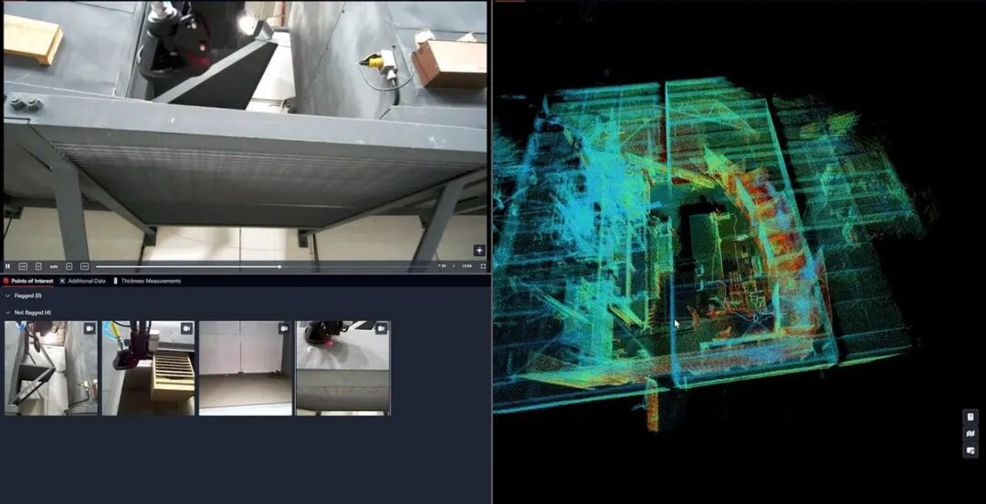
Scout Portal: live imagery and 3D data viewed on the same screen
For shipping, offshore and industrial companies, this digital approach to management can help on-site personnel and supporting technical teams communicate inspection findings more intuitively, providing a basis for subsequent review, repair planning and equipment condition management.
The value of industrial drones lies not only in obtaining clearer images, but also in giving inspection data spatial context and traceability.
From 4K image acquisition to 3D spatial visualisation, Scout 137 Gen3 is combining multiple technologies to provide a more systematic, digital solution for confined-space inspection.
Tecway can provide Scout 137 GEN3 industrial drone equipment sales, operator training and professional inspection services.
About Tecway
Tecway International Limited was established in Hong Kong in 1993 and is a leading technical consultant and high-quality distributor serving the global maritime industry. With more than thirty years of accumulated experience, it has developed five core business segments: marine equipment, petrochemical storage and transportation, diesel and internal combustion engines, maritime technical services and maritime consultancy services. Its business covers major markets including China, Southeast Asia, the Middle East and Europe.
Tecway Maritime is a professional team specialising in green shipping and maritime consultancy services. Focusing on shipping companies' low-carbon transition and regulatory compliance needs, it provides EU ETS, UK ETS and FuelEU compliance consultancy, EUA/UKA allowance procurement support, FuelEU Pooling services, support for green marine fuel projects, export solutions for Chinese-manufactured marine equipment, industrial drone solutions from Norway's ScoutDI, and FGSS/CHS technical services for dual-fuel vessels.
We also serve the diesel and internal combustion engine manufacturing industries, supplying products such as the Cylinder Liner Diameter Measurement (CLDM) system and providing technical support. From sales consultancy, installation and commissioning to training and after-sales service, our rapid-response service network is trusted for its expertise and reliability.